
Work with ESRI ArcGIS Mobile Apps (Android)
Your Geode GNSS receiver will work with ESRI ArcGIS mobile apps, such as ArcGIS Field Maps or ArcGIS Survey123. There are two methods to connect a Geode:
Direct Connection to the Receiver. Used with embedded correction services such as SBAS, Galileo HAS, and Atlas L-Band. (See Method 1. Direct Connect to the Receiver in Field Maps or Method 1. Direct Connect to the Receiver in Survey123.)
Mock Location Provider Connection. Used when Geode Connect functions as an NTRIP/RTK Client App. (See Method 2. Connect with Mock Location Provider#method-2-connect-with-mock-location-provider.)
Method 1. Direct Connect to the Receiver in Field Maps
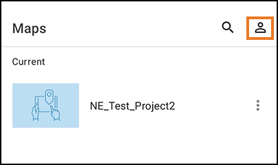
To connect the Geode in Field Maps,
Tap the profile icon.
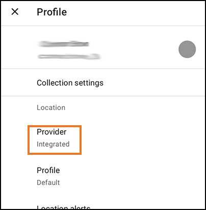
Tap Provider.
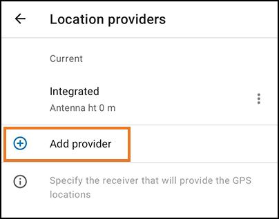
Tap Add Provider.
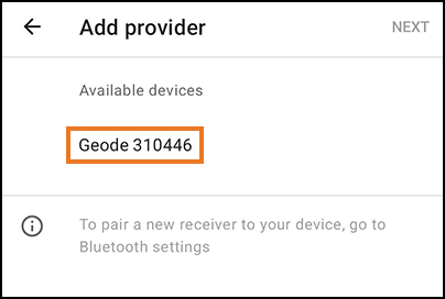
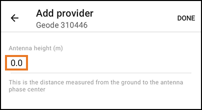
Tap Geode XXXXXXX. (Each Geode has a unique number, represented here by Xs.)
Enter the value for height of your antenna.
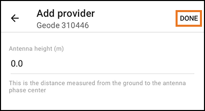
Tap Done.
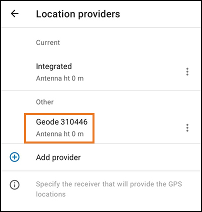
Tap Geode XXXXXX to set it as the current provider.
Tap the back arrow.
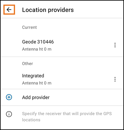
You can now see the Geode listed as the provider.
You are now ready to use Field Maps with Geode.
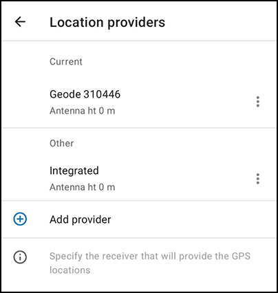
Method 1. Direct Connect to the Receiver in Survey123
To connect the Geode in Survey123,
Tap
 .
.
Tap
 .
.
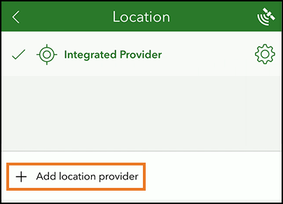
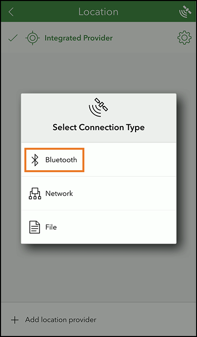
Tap Add location provider.
Tap Bluetooth.
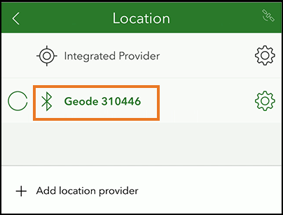
Tap Geode XXXXXX. (Each Geode has a unique number, represented here by Xs.)
Tap
.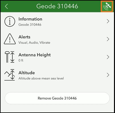
You can now see the Geode listed as the source.
You are now ready to use Field Maps with Geode.
Method 2. Connect with Mock Location Provider
Geode Connect 2.5.0 paired with a Geode receiver can obtain NTRIP/RTK GNSS receiver metadata and pass it to ESRI ArcGIS mobile apps, such as ArcGIS Field Maps and ArcGIS Survey123. When using NTRIP/RTK with the Geode and ArcGIS mobile apps, you will
Configure Geode Connect as the mock location provider.
Start NTRIP/RTK in Geode Connect. Leave Geode Connect open.
Connect to in the ArcGIS app. See Field Maps with NTRIP or Survey123 with NTRIP.
For a list of the mock location extras that are passed through Geode Connect, see Geode Mock Location Extras.
Method 2, Step 1. Configure Geode Connect as the Mock Location Provider
If you will be using NTRIP/RTK correction service, follow the instructions to configure Geode Connect as the mock location provider. Complete the steps in both Enable Developer Options in the Android OS and Configure Geode Connect.
Method 2, Step 2. Start NTRIP/RTK
To use the NTRIP/RTK correction service with Geode Connect as the mock location provider,
Open Geode Connect.
From the menu, select Receiver Configuration > NTRIP/RTK Configuration.
Establish an NTRIP/RTK connection. For more details, see the GNS3 User Manual, Geode Connect for Android / Learn Geode Connect / Configure NTRIP/RTK (page 152).
Tap Start NTRIP/RTK.
Keep Geode Connect open while using your ESRI ArcGIS app.
Method 2, Step 3 (option). Field Maps with NTRIP
To verify that Field Maps is connected to the Geode,
Tap the GPS accuracy text in Field Maps.
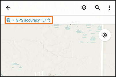
Check that your Geode shows as the provider. (The numbers on your Geode will be different from those shown here.)
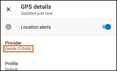
Close the GPS Details screen.
Tap the profile icon.
Verify that Provider is set to Integrated.
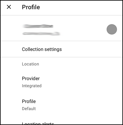
You are now ready to use Field Maps with the NTRIP/RTK service through the Geode.
Note: You will need to keep the Geode Connect window open to maintain your NTRIP/RTK correction service.
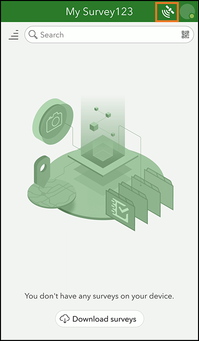
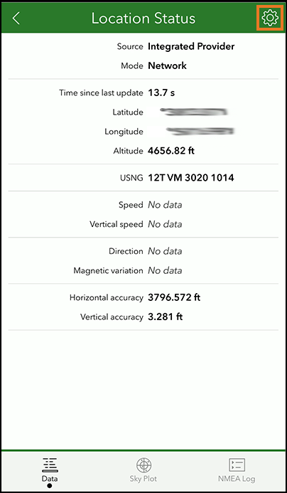
Method 2, Step 3 (option). Survey123 with NTRIP
To verify that Survey123 is connected to the Geode,
Tap
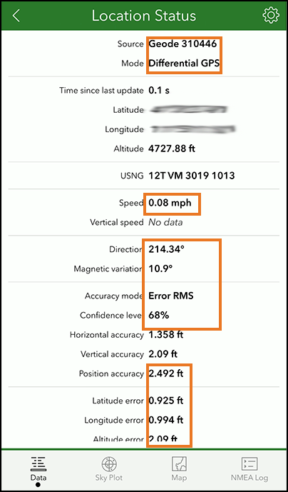
in Survey123.Verify that GeodeConnect is the source.
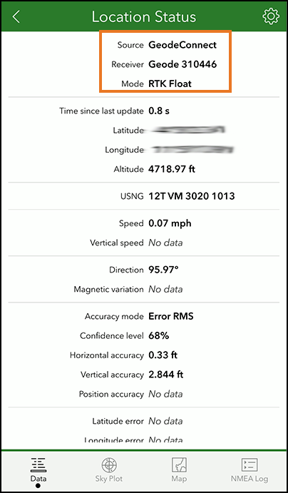
Tap
.Verify that Integrated Provider is selected.
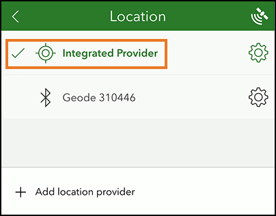
You are now ready to use Survey123 with the NTRIP/RTK service through the Geode.
Note: You will need to keep the Geode Connect window open to maintain your NTRIP/RTK correction service.