Decode the Skyplot Screen
The Skyplot screen shows which satellites are being used in the positioning solution and where they are in the sky. It also shows satellites that are being tracked.
On the Skyplot screen, each satellite is identified by a space vehicle number (SVN) and color for its constellation. The location of each satellite on the Skyplot indicates its location in the sky relative to true north. The outside ring is 0° elevation (horizon). The inside ring is 45° elevation—halfway above the horizon from your present location. The intersection of the two lines indicates directly overhead.
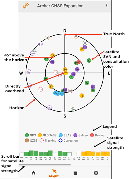
The color of the satellite outline shows the connection status.
- A red outlined satellite is being tracked but not part of the positioning solution.
- A blue outlined satellite indicates that a correction is being applied to the signal and is part of the positioning solution.
The Skyplot screen is meant to be used as a guide. It shows the relative visibility of satellites in the sky, but it is not an absolute reference for satellites used in the positioning solution.