Products ▾
![]()
GNSS RECEIVERS
TOTAL SOLUTIONS
Industries ▾
Partner ▾
GNSS RECEIVERS
TOTAL SOLUTIONS
Juniper Aspect Field Mapping Solutions is a mobile, state of the art mapping solution for field professionals. Designed with flexibility and customization in mind, Juniper Aspect meets the unique and specific mapping needs of each user, resulting in accurate as-built and field asset documentation verified by GIS technology. The intuitive user interface of Juniper Aspect is tailored to field crews and maintenance technicians, promising ease of use and simple adoption into everyday processes.
Try a FREE preview version of Juniper Aspect!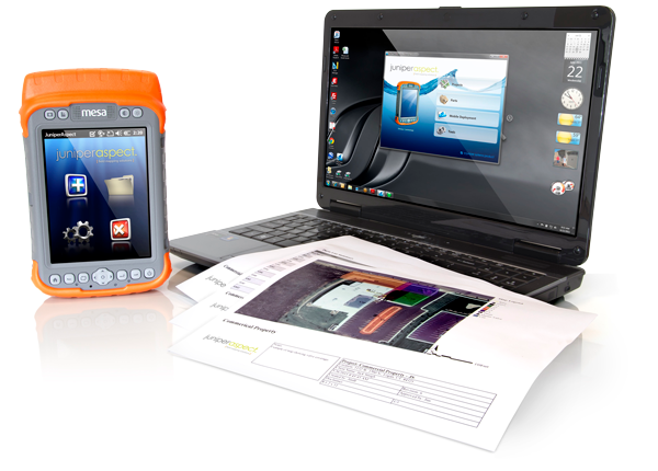
The entire deliverable of Juniper Aspect is to create accurate as-built documentation, as well as map asset or object locations with descriptive information and geo-tagged photographs. The collected information from the handheld seamlessly synchronizes to the desktop version of the software where custom reports are generated based on individual mapping needs. Users can edit, manage, and present the maps in whatever way desired, resulting in a printable file that contains maps, photos, part lists, coverage areas, notes, and more.
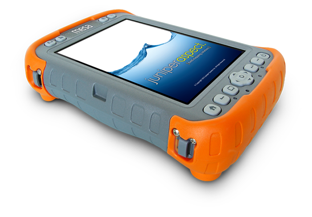
Before heading out to map, users are able to download a base map from the desktop version of the software onto the Mesa Rugged Notepad or Archer 2. Once out on the job site, the user enables the GPS and hits the ground running. For users requiring improved accuracy, the Geode Sub-meter GPS Receiver can be used as an affordable way to ensure all collected data meets necessary precision requirements. While working, Juniper Aspect allows the user to overlay the mapped objects on to aerial photographs, mapping everything from irrigation systems, trees and vegetation, utility meters, street and traffic signs, water coverage, repair locations, and more. Object information can be specified down to manufacturer, series, part numbers, and descriptions, thanks to the extensive master objects catalog and unlimited number of flexible custom objects catalogs.
By implementing Juniper Aspect into everyday operations, landscape and irrigation professionals are able to generate new revenue and reduce costs, resulting in a higher profit margin. Juniper Aspect allows landscape and irrigation professionals to:
What makes Juniper Aspect so valuable? Its ability to create accurate graphical as-built and field asset documentation of irrigation systems, trees and vegetation, utility meters, street and traffic signs, water coverage, repair locations, and more. Whether you need a PDF file, Excel spreadsheet, or hard copy printed maps, Juniper Aspect delivers with a unique, easy-to-use tool. Generate custom reports and maps containing parts lists, photos, notes, and even your own company’s logo. Click on the sample maps below to discover what Juniper Aspect can do for you. Or get started with a FREE preview version of Juniper Aspect today!
Juniper Systems offers world class support for its complete lineup of rugged data collection products. Please click on the links below to find valuable resources related to your rugged handheld computer or data collection software.


