Agriculture

Designed For Agriculture

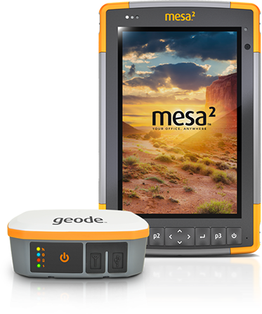
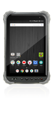
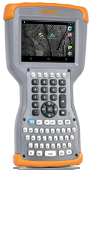
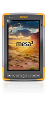
We specialize in rugged data collection solutions built tough enough to operate in the scorching summer heat and withstand that unexpected downpour. Juniper Systems was founded with agriculture customers in mind, so we thoroughly understand the needs of the industry. From our HarvestMaster seed research systems, to our rugged tablets, handhelds, and GPS receivers, we have a solution to keep your crews productive and your yields high.


If you are an agriculture research professional, please visit our HarvestMaster division to learn more about the seed research solutions and innovations we provide, including the new H2 GrainGage and Mirus data collection software.

We are happy to assist you in identifying a reliable hardware/software solution to meet your agriculture mobile data collection needs. Contact Juniper Systems today for additional information and pricing!

Agronomy and Soil Sampling

Farmers and producers can enhance their decision making capabilities and increase profitability with Juniper’s rugged hardware paired with compatible crop management software. Packaged GIS mapping solutions with the Mesa 2 Rugged Tablet and the Geode Sub-meter GPS receiver provide all-in-one fully integrated mapping system to achieve high accuracy at minimal costs. Contact us and we’ll help you find the best solution for your operation.

Mesa 2 Rugged Handheld and Geode

Crop Management Applications

All Juniper Systems rugged handhelds and tablets feature an ultra-rugged design (waterproof, dustproof, shockproof), sunlight readable displays, long battery life, ergonomic design, and field-swappable batteries. Options for GPS, cameras with geotagging capabilities, barcode scanner, and RFID are also available.

  • Business Operations
  • GPS and Mapping
  • Record Keeping
  • Crop Scouting
  • Soil Sampling
  • Instrumentation Data Collection

GPS Software Available Through Juniper Systems

Juniper Systems is authorized to sell the following GPS software. Please contact us for more information or a price quote.

ESRI

ESRI GIS
An all-inclusive geospatial software allowing users to capture, edit, analyze, and display geographic information. Click here for more information.

Effigis OnPoz Precision Positioning Software

Effigis OnPoz Precision Positioning Software
A complete suite of applications that allow you to easily and accurately collect, record, and post-process geospatial data for sub-meter GPS accuracy. Click here for more information.

StarPal

StarPal HGIS
Easy-to-use mapping software perfect for soil sampling, GPS mapping, area mapping, finding center points, and conducting electromagnetic surveys. Click here for more information.
Contact our experts for other software recommendations.

LIvestock Management Solutions

Ranchers, livestock producers, and large-animal veterinarians work in conditions that make inferior data collection equipment shake in the stirrups. From scanning ear tags on the business end of a busy corral chute, to performing pregnancy checks at top producing dairies, Juniper rugged tablets and handhelds are built to withstand the rigors of commercial livestock operations.

Livestock Applications

All Juniper Systems rugged handhelds and tablets feature an ultra-rugged design (waterproof, dustproof, shockproof), sunlight readable displays, long battery life, ergonomic design, and field-swappable batteries. Options for GPS, cameras with geotagging capabilities, barcode scanner, and RFID are also available.

  • Business Operations
  • GPS and Mapping
  • Electronic Livestock Mgmt.
  • Ear Tag Scanning
  • Electronic Livestock Traceability
  • Animal Health
  • Brand Inspection
  • Reproductive Herd Mgmt.

Contact our experts for herd management software recomendations.

Geospatial Solutions for Agriculture

Need a GPS fix? Juniper Systems rugged handheld computers are your surefire solution for simple and accurate GPS data collection. There are multiple GPS options for each of our rugged field computers, whether you’re looking for 2–5 meter, sub-meter, or centimeter accuracy. Learn more by downloading our Geospatial Solutions product sheet today.

Not only do we provide the hardware for GIS and GPS applications, we also offer several GPS software packages and compatibility options for other common software in the mapping industry.

GPS Software Available Through Juniper Systems

Juniper Systems is authorized to sell the following GPS software. Please contact us for more information or a price quote.

ESRI

ESRI ArcPad
An all-inclusive geospatial software allowing users to capture, edit, analyze, and display geographic information. Click here for more information.

Effigis OnPoz Precision Positioning Software

Effigis OnPoz Precision Positioning Software
A complete suite of applications that allow you to easily and accurately collect, record, and post-process geospatial data for sub-meter GPS accuracy. Click here for more information.

StarPal

StarPal HGIS
Easy-to-use mapping software perfect for soil sampling, GPS mapping, area mapping, finding center points, and conducting electromagnetic surveys. Click here for more information.
Contact our experts for other software recommendations.

Mapit for Android

Mapit for Android
Affordable, user-friendly, and powerful mapping application for Android with the ability to map points, polygons, and lines, import layers from files (.shp, .kml, .csv), export to files (.shp, .kml, .csv, .gpx, .json, .dxf), and create custom attributes associated to points, lines, and polygon features. Background maps are also available, even without data coverage.

ATV Mount Options

Users can transform an ATV into a rugged field data collection machine with the use of our Mesa 2 Rugged Tablet paired the Geode Sub-meter GPS Receiver. With a sunlight-readable display and an all-day battery life, this solution is ideal for soil sampling, field perimeter mapping, asset mapping, pivot-center point mapping, and other mapping applications. Juniper Systems products are compatible with Ram, ProClip, and other popular mounting systems.

Contact Juniper Systems for more information

EmberEquine Ultrasound Reproduction Solution

EmberEquine™ is the ideal solution for equine veterinarians seeking an efficient way to perform mare ultrasounds and keep mare records. As a completely wireless touchscreen-operated solution, users can capture ultrasound measurements directly on the Draminski 4VetJ Ultrasound screen, while owners or vet technicians enter mare information on the waterproof Mesa 2 Rugged Tablet. Using Juniper’s cutting-edge EmberEquine software, vets can then send exam information, including ultrasound images, to mare owners while storing the records for future reference with the touch of a finger.

  • Touchscreen Interface
  • All-Day Battery Life
  • Wireless Connectivity
  • Quick Data Entry
  • Easy Access to Historical Mare Records
  • Cloud-Stored Exam Data
  • Efficient Client Communication

Visit our EmberEquine page for more information.

Literature Downloads: